Thursday, 29 January 2009

First pedal strokes? And I just don't believe it.

It's been awhile since my last post, but getting on the computer to type requires a good deal of time, something I'm not well endowed with these days. True I do get big gaps in my shift pattern, but once I've spent a couple of hours out on the Subway 1, and then done some chores, or gone out shopping, or for a walk with Elizabeth etc., it's a struggle to lock myself away here on the pc.

Having said that, the weather here has been changeable to say the least. Last weekend it was cold and icy, so much so that I got my new trainer out, for a first go on Saturday. Thanks to my son Tierloch, who solved my inevitable misconstruction, it was ready and waiting to be connected up to the Subway. I'd got up early, which I usually do when I'm going on one of my leisure rides, but chickened out as soon as I saw frozen water, on the back path. So I set the trainer up and attached the Subway, and was taking my first tentative pedal strokes at 07.30. I tried the various resistance settings, and was impressed.

I had a run at setting 3, for 15 minutes, which brought me out in a sweat, had a glass of water, did another 15 minutes, another glass of water, then rounded off with a 20 minute session, varying the settings. Perhaps it was the fact, that I didn't have the cooling effect of the bike moving through the air and a breeze, but I worked up quite a sweat, and could feel the effect of the workout, on my legs.

My overall reaction is good, when it's icy I can get a ' ride ', but pedalling and not actually getting anywhere, having nothing to interact with as you pass and see things when on a normal ride, is a terrible bore. So when I set it up next time, I'm going to be prepared, either by way of something to read, or an audio book to listen to. Reading will be a problem though.


A major drawback, which hopefully I can rectify, is the fact that when assembled with the trainer, the Subway slopes forward at an angle that I find uncomfortable on my hands. The simple answer is, I hope, a matter of raising the front wheel up by about 2 inches, so making the whole assembly level. I'll keep you up to date on developments, but, as I said the weather is very changeable, and has now gone back to a very mild phase, and I've commuted to and from work 3 times in the last week.


The first commute after my efforts on the trainer was great, I kept imagining to myself that my leg strength had improved, but after that my trips to and from work became really hard work, and I seemed to be getting overly tired for no reason.

Same thing happened today, when I went for a leisure ride with my camera. It seemed hard work over stretches I've cycled now, many, many times. Taking pictures was a relief. Here are some.


This first shot is taken from the old road looking down into the valley, through the trees to the fertile plain below.


And this is the road that meanders along northwest side of the valley.

A big change of subject here. Above shows a pair of workers' cottages, set next to the old coach house and stables, part of a large estate at Rheola pond. I don't know any of it's history, but have decided to find out more asap.


Here I'm looking the other side of the cottages towards Rheola pond, I think you can see that the views have been 'managed' i.e., in the past the owner of the large house did some landscaping to enhance the views.


Looking again toward the pond, and once more I believe one can see the 'managed' setting.


Here is the drive up to the big house, on the right is perhaps a gatekeepers house. Note the sweep of the road with an old dissused factory on the left.


This is the gatekeeper's house again showing it's relationship with the workers' cottages and the stables.

This is a stream which has been walled either side, and is a major feeder for the canal across the road. If you expand the picture you will see it also acts as an overflow for Rheola pond on the right.


Another shot looking up towards the big house, set in the trees at the back of the bold sweep of grass, between the stables on the right and the main house itself.


I said the factory was dissused, but in fact it is now in use by demolition experts, who reclaim stone and timbers from old schools and churches etc., selling it all on to be used again. The factory building meanwhile has found a new purpose, being used every Saturday to house an indoor market, which is very popular in these parts.


As I left the factory I noticed a farmer feeding some horses, across the road, on the other side of the canal, I said a quick hello, and took a couple of picture of their horses.


I left the farmers and their horses and decided to cycle on down the canal towpath to Resolven.


I stopped to take the above photo, it shows a small barge that is used to cut back weeds from the canal sides, a lock and an overflow, used to take excess water away when the lock is closed.


I took this shot from the canal towpath looking north at Rheola forest, which occupies the escarpment separating the Neath valley from Crynant and Seven Sisters.


To my dismay I found that the batteries in my camera had run out, so I put the camera safely in my jacket pocket, and cycled on towards Resolven.


This is where " I don't believe it " comes in. It's the catch phrase of Victor Meldrew, a popular sitcom character on TV, because you wouldn't believe how many things I saw that I wanted to photograph, on the rest of my trip. It was only a couple of hundred yards further on, when I came within 10/15 feet of a dipper. Like an oversized robin, but with a white chest, and darker brown everywhere else, a really smart looking bird, that bobs while standing still. They always make me think that they're wearing an extremely white bib. It's a bird that lives by waterways, feeding on worms, underwater grubs etc., and dives under water to seek it's food out, hence the name dipper. The really amazing thing about these birds is that, while under water they actually swim using their wings.


Anyway, this little fellow was stood in a feeder stream alongside the canal, bobbing, and despite my presence continued to have a good wash, I know I could have taken a great picture save for those darn batteries,........"I just don't believe it"


I carried on toward Resolven, and soon I met a party of walkers, about 15 strong, heading towards me, I gave them cheery " good morning", but all I got in return was a faint hello from one of their party, and sullen looks from the rest. I got the distinct impression that they disapproved of a cyclist sharing "their" towpath?? In fact they made sure I had to leave the towpath to pass them, despite there being more than enough room for us to pass.


A few minutes later I was turning round at Resolven, and because of the miserable walkers, I decided to make the return leg to Glynneath on the road. Just like my last couple of commutes, I found it tiring on the inclines. So when I got as far as Cwmgwrach I decided to have a coffee at MacDonalds. After my coffee, I checked out my bike, and found the back brake was rubbing the wheel rim quite badly, so I adjusted it as best I could, I'm far from mechanically minded, terrible with a spanner or any tool, for that matter, but my efforts eased the problem.


Leaving MacDonalds, I decided to cycle up to Pontneathvaughan, after having exchanged text messages with Elizabeth, who I was due to pick up from her hairdresser at 12.30, when she told me it would be after 1.00., before she was ready.


When I got to Pontneathvaughan, I decided to take a trail I've never been on before, well only a small part of the way. It was to go to the gunpowder works, at almost the head of the valley. I'd stopped short of going all the way up the trail previously, because of dogs, or the possibility of dogs, at the couple of residences along the way.


In places it was very muddy indeed, and I struggled to keep the Subway upright, but I enjoyed the ride and the views, again wishing I had a working camera with me. The ride to the gunpowder factory, well the remains of, took about 15 minutes, and was well worth the effort.

I was so disappointed at not having the camera, but I had a thought, perhaps the batteries had recharged enough for a couple more shots.


I got out the camera, and turning it on was delighted to see the green light flashing, so hastily I took this last shot, and last shot it was because the batteries died for good immediately after.


It shows the river passing through some sort of manmade damn, obviously something to do with the gunpowder works, which I will return to get some shots of, and find out some of its history.
Well, then it was a quick return down the trail to Pontneathvaughan, then by the road to Glynneath and home.
Cheers for now.


Tuesday, 20 January 2009

Brrr!!

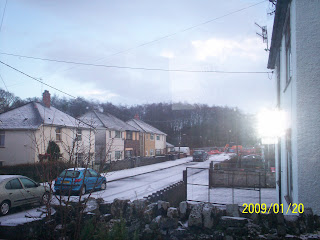
This is what we woke up to in Glynneath today, a layer of hailstones a couple of centimetres thick. It was kind of slippy so my bike stayed in the shed, nowhere else had this layer, including the rest of the village, and as the blue sky promised it was to be a lovely day, plenty of sunshine, with only a couple of showers of sleet.


My worry is that it'll be icy and slippery tomorrow, when I have to return to work. I'm still a big coward of icy roads and paths. I've swapped so have to be in by 08.00, not my usual 05.30. I'm hoping things will be clear and dry by 06.00., when I have to start the trip.
Fingers crossed!

Yesterday I went for a ride on the Subway, around the local area. I took quite a few photographs, but that is when my lack of expertise came through, and big time. I went out as early as I could, just as the light was dawning in the valley. But it remained not light enough for the next hour or so, and my pictures came out too dark to show any of the detail, that I wanted to show. So I've only uploaded the best of a bad lot.


This one above shows the pedestrian/cyclist underpass, below the A465, from the bridge on Chain Walk ( must be a history to that name )


On the same bridge looking at the A465 as it rises, on its built up embankment, to cross above the underpass.


Just a nice shot of the river, well it would have been, if I'd known what I was doing photographically, as it heads towards one of the A465 flyovers.


This is some waste ground between the river and the A465, note the surface water, which illustrates how much rainfall we've had these past days and nights.


Same waste ground looking in the other direction.


I thought this could be a lovely shot, but the light let me down. It shows an old rail bridge, with footpath, which in its heyday, helped carry coal from Merthyr down to Swansea docks.


The same bridge looking straight across it, the rails and sleepers are still in place, I think the footpath must have been added later, which judging by the sign, hasn't lasted as well.


Enough said.

Monday, 19 January 2009

Haven't much time to write.....

So I'll be quick.

Got called in for an overtime shift last Saturday. The forecast was dreadful, but I went on my Subway 1 anyway. I expected to get drenched, however, the ride into work wasn't anywhere as bad, as that. Had to put up with a bit of a headwind, while travelling down the valley, but hardly got wet.

While at work, the weather worsened all through the day, just as the weathermen had forecast, so by the time came to make the trip home, there were gale force winds and deluges of heavy rain, blowing and falling. The lads at work all agreed I must be mad to travel home on the bike in such weather. Kerwin even offered to drive me and the Subway home. I thanked them all for their concern, insisting I'd cycled home before in even worse conditions.

The winds were fierce, but in fact were mainly at my back, and being well prepared gearwise, my beanie hat, goretex workcoat, waterproof trousers, and neoprene overshoes, all kept the rain at bay. The ride was fantastic, I don't believe I've ever experienced such a tailwind before. It made cycling back up the valley, and particularly the hill at Aberdulais, a breeze, if you'll excuse the pun. It was almost like surfing the wind.


Normally the return trip from work to home takes me an hour and a half, Saturday I did it in 75 minutes, with no extra effort on my part, it was all down to mother nature.

Fantastic, cheers.

Thursday, 15 January 2009

This is me in the local paper, fame at last.

Sadly, you can't believe everything that you read, the reporter embellished the facts a little. To date I've only lost 1 and a half stone in weight, not 3 stone. However, I do try to commute to and from work, every day. Since starting to cycle I feel great, and would recommend it to everyone.
The picture and story appeared in the local "Neath Guardian" newspaper, the reporter, to my amazement, had discovered my blog, and sent me an email, asking if I'd mind him writing a piece about me. This happened just a few days after my fall on ice, my smile in the picture, is really a grimace of pain, as my shoulder was still very sore.
Anyway , I just thought I'd let you all see.
Despite very windy and wet conditions out today, I went for a ride on the Subway 1, for the fourth day on the trot. I'd promised a former neighbour of ours I'd call up to see him. Up is the right word, he now lives in Aberaman, a village the other side of Aberdare. Only about 8-10 miles away, but quite a climb up out of the Neath valley, over Rhigos, through Hirwaun, and then dropping down into the Cynon valley.
It's only recently, back in November, that I'd first climbed all the way up the Rhigos bank, as it's called locally, and then after a good couple of hours riding. This morning I thought about and decided against doing a warm-up, like a swift ride through the village. Big mistake, I had to stop three times on the climb, making my excuse, to myself, that I wanted to take a photograph or two. I managed OK for the rest of the trip, and spent an hour with Peter McNemin, chatting about old times etc.. It was good to see him again.

This is where I made my first breathless stop, probably a third of the way up the aforementioned Rhigos bank, looking back down the hill. Below is a pretty waterfall, that I "had" to take a picture of, for my second.

While this one below, is taken from close to the top of the Rhigos bank, looking back down and across the Neath valley, please excuse the raindrops on the photo.

This one isn't a very good shot, but the best I could do from the roadside. The houses that are peaking through the trees, are Pontneathvaughan, or Pontneddfechan in Welsh, a small village about 2 miles up the valley from Glynneath, Cwm Nedd in Welsh.

Another shot from the top, looking north towards the Black mountains, if my geography is correct.

All in all it was a good morning's ride, I left at about 09.30, got to Pete's at roughly 10.45, spent an hour over a couple of cups of tea chatting, he also told me a few things about this digital camera of mine, that I know next to nothing about. Consequently, I now can store vast quantities of photos on it, instead of being limited to only 12. The trip back home was uneventful, but I did get very wet, and I discovered a new bicycle path, the Cynon trail, which I will need to explore in the future.

So a nice morning and I learnt something as well, to take the time to warm-up, before going straight into a climb, as well as better knowledge of my camers, cheers.

Tuesday, 13 January 2009

Just another local ride...


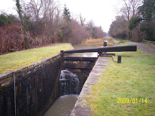
The following are various views of my trip today, showing the type of cycle path I was on, and the restored lock gates, at different locations between Cwmgwrach and Resolven. Also a solitary swan that has taken up residence on this part of the canal, waiting hopefully for a mate to chance by.


This shot on the left shows the canal on the left side of the bicycle/towpath, with the river Neath down on the right, beneath the trees. The engineers who built this canal were very skilled, I find it fascinating travelling alongside it, seeing the various water feeds flowing into, and excess water channels flowing from it, all in order to keep the canal at its optimum depth/draught, to facilitate the barge traffic, now sadly gone.


Waited till 09.00 to go out on the Subway 1, took my digital camera with me, intending to take some photos. The decision to leave so late was simply that I wanted daylight, not only for the photo taking, but also, so that I was plainly visible to traffic. I was unsure which way I'd be heading, and just decided to follow my nose, at an easy pace.

Here's the Suway 1 ready to roll.


First, I rode down through the village, past Cwmgwrach washery, where the mine seems to be expanding, increasing production now that the price of coal has increased so much. Same too, for Unity mine, on the other side of the valley, coal trains are starting, so we're told, some time this month, to transport it down to Swansea, two trains a day. That is good news for this part of the world, in these times of recession.

While I cycled I began again to think of the history of this valley, of which I know so little. When coal was king, as they say, these two mines were big producers, employing hundreds of miners, now at a guess they employ perhaps dozens. But it was coal that built the villages of the Neath valley.


I'd very much like to study the history of the valley, time is the key though.
Getting back to my ride, just below the washery I took the cycle path down towards the canal, below is a view of it.


Before joining the canal I took a short detour, across the old iron railbridge over the Neath river. I took a picture of the bridge, built to transport the coal from the washery, to the railhead on the other side of the valley, or to the coalbarges on the canal.


You can see the old rails still in place. And here's a shot of the Neath river as it flows under the old bridge towards the motorway bridge just to the south, old and new together, along with a bicycle path to view it all, I have to admit I'm very fortunate in where I live.

While on the bridge I met Terry an old acquaintance of mine, who was out walking his dog. He told me that he'd seen my photo in the local paper, something I've yet to mention in this blog, I think, but my memory is likely to play tricks with me, it's really bad these days. I'll have to check back, before risking repeating myself. We both agreed how lucky we are to live in this part of the world. Terry's retired now, these past 5 years, and likes to keep active walking his dog for miles, up to the hills either side or along the valley floor and canal.

I explained that I wanted to take my bike up into the forestry roads, on the valley sides, all the way up to the top, where there is a rough road that is used by stone lorries, carrying loads from a quarry. I asked him if he knew how to get there, he told me he often walked his dog up there, and gave me directions. We said our goodbyes, and I cycled on to the canal path, while Terry continued his walk with his dog. It was nice to meet and chat awhile with Terry, we live perhaps a mile from eachother, but I hadn't seen him for years. That surely says something about how we're all isolated, in many ways right within our own communities. Few of us get out there and do things within our communities, we're all too busy, earning a living, watching TV, playing computer games, or TYPING ON THE INTERNET, so I'm just as guilty I suppose. A little bit more on that subject, later, if I've time, and of course remember.

Yet again, I digress, my ride continued through a very muddy section of the canal towpath, when I noticed a gate, normally padlocked, was open, leading away to the farmland to the left of the canal. It's tarmaced, and I have been down it a couple of times before, but had never taken any pictures. So I followed the road, as it led under the motorway, shown above, then became a rough track running parallel to the motorway, travelling to a couple of large ponds. These two ponds were created along with the motorway, manmade, when the earth was dug up from the valley floor to produce the embankments that the motorway is built on. Thinking of it now, what a waste, that soil so rich and fertile, from a mature river valley floor, thousands of years old. What would so many gardeners pay for such fertility now? But alas it's gone never to be replaced.

Very often Elizabeth and I stop to look at these ponds from a layby, next to the motorway, otherwise known as the A465, or Heads of the Valleys road, crossing as the name suggests, the heads of the Rhondda, Cynon, Taff, Rhymney and Usk valleys of South Wales. We look at the ducks, and a pair of resident swans, which we are very fond of. They've been in residence for a couple of years now. The ponds are used quite a bit now for adventure sports, waterski-ing, jetski-ing, canoeing etc.. It seems to be a developing business.

There's a gate, usually locked, that opens into the field that contains these ponds. Today it was open, with a security guard on duty. As I approached he stepped into the gateway, to ask me what my business was. I asked him if I could cycle on down the track to view the ducks on the ponds, and maybe take some photos. He replied that it was OK to do so, and in future if the gates were locked it would be OK to leave the bike at the gate, climb over and walk around the ponds. I thanked him, and pedalled on the couple of hundre yards or so to the pond shores.

This is a view of the largest pond, but at the end of the gravel track. I wanted to go further, but the ground was very wet, from two days of heavy rain, and my cycle shoes simply aren't up to walking in squelchy mud. Of course the ducks and swans reside at the far end, so no chance of taking some pictures of them, oh well.

There is a small isthmus that seperates the two ponds, today there were a team of divers, three in all, preparing to "check things out," as the security guard put it? When I took this photo they were perhaps 50 feet to my left, on the above mentioned isthmus, they totally ignored my friendly "Good morning" greeting, consequently I chose to pretend they weren't there, also.


This is a shot, looking back up the valley at the smaller pond, you can see the tailend of one of the 4x4's, three in all, used by the divers.

I asked the security guard how deep these ponds were, he reckoned the smaller was 11 metres, and the larger 17 metres deep. That's pretty deep, and must convert to hundreds of thousands of tons of earth dug up to support the A465. I said earlier what a waste, but the resulting scenes aren't too bad, are they? Considering also that the A465 was only about 50 yards to my left, when I took this shot.


This last picture shows the scene from the top end of the smaller pond, looking down the valley. You can see the thin isthmus that seperates the ponds, and that black dot on the right of the isthmus, is one of the divers' 4x4's. If any of you have the facility to magnify these shots, as I seem to have when I look at your blog shots, you will see alot more detail.

By this time it had started to rain lightly, so I cycled to the left of this shot, along a very soft dirt track.


This is what I found, I'd never noticed this old building before, hidden as it is amongst some trees. It appears to be very old, the stonework is very thick, and obviously has been abandoned for a very long time. The security guard, told me, when I asked if he knew anything about it, he'd been told it was the remains of an old pub.
Which brings us back to history, particularly of this valley where I live. It is all around us, yet we fail to see , enquire about , just plain ignore, or are simply too busy to appreciate it.

I heard a fitting saying recently, it went:-

" ....to forget the past is to have no future..."

That about sums it up I think, I just wish I had the time to find out more. And another thing I must, have to improve my typing skills, it's taken me 2 hours to get all this down, and I've so much more to say. For now it will have to wait for another time.


This is the canal basin at Resolven, it's a dead end here, but the canal used to continue, unbroken straight to Port Tennant in Swansea. I presume that there used to be tunnel for the barges to pass under the road, at the far end of the basin you can see where the water now flows under the road via the two arches.